Comments on the extreme December 2016 Arctic cyclone and its impact on the Barents-Kara seas
Here we take a closer look at the "extreme" cyclone that hit the Arctic a few days ago (20th-22nd December) and was strongly implicated in the extremely high temperatures observed across the Arctic . This event follows, almost a year to-the-day, a similar cyclone that hit the Atlantic sector of the Arctic last December (2015).
That event, and its impact on the Barents-Kara sea ice cover was explored using NASA's Atmospheric Infrared Sounder (AIRS) instrument onboard NASA's Aqua satellite, and was recently published in Monthly Weather Review . The paper was also the topic of a NASA press release and visualization.


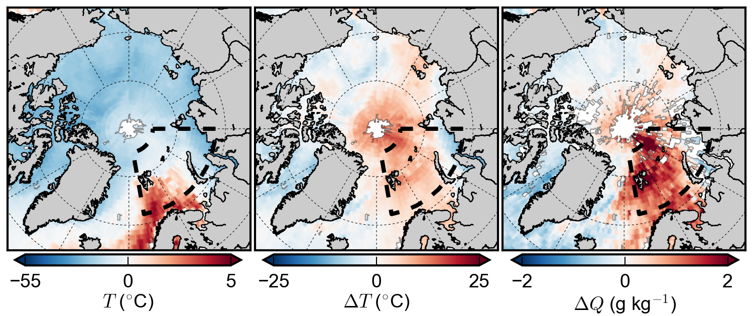
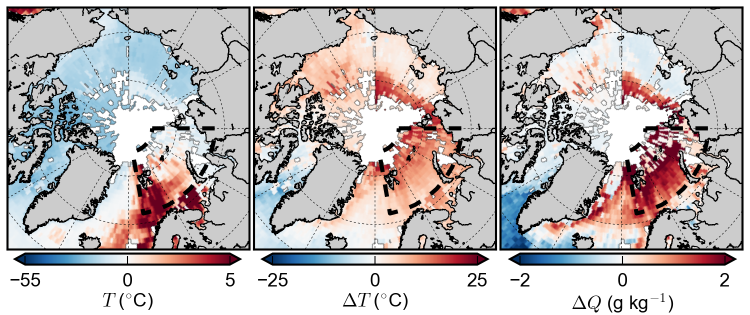
Like the December 2015 event, the cyclone (centered broadly northwest of Svalbard) transported a very warm and humid air mass into the Arctic, through the Atlantic sector, causing warmer near-surface air temperatures (~4.5 C, 1.5 standard deviations above the 2003-14 mean) and wetter, more humid, conditions (1 g/kg, >3 standard deviations above the 2003-14 mean) on December 22nd, 2016 in the Barents-Kara seas region.

The storm also carried in very warm temperatures into the area surrounding the North Pole, with temperatures climbing above freezing (a peak of +0.85 degrees Celsius in some grid cells near the North Pole) on December 22, 2016. We do not expect the North Pole to see temperatures above freezing in winter and we continue to be surprised by these observations. Specific humidity near the North Pole was ~3.9 g/kg, around 3 g/kg wetter than normal for winter.
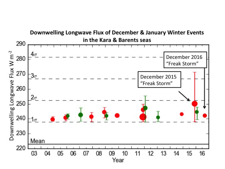
This storm, although very comparable in magnitude to the December 2015 storm resulted in less of an extreme increase in downwelling longwave radiation in the Barents-Kara seas region. This is most likely due to the difference in storm tracks between the two events. It may be that the storm was of a similar, or even higher downwelling magnitude, but in a slightly different region to last year's event. We need to look into this in more detail.
We are also still exploring the direct impact this event had on the Arctic sea ice pack, however a significant retreat of ice in the region has been observed in the near real-time satellite ice concentration data.
At the end of our paper on the 2015 storm we hypothesized that if these extreme winter Arctic weather events become more frequent, they could result in significant disruption to Arctic sea ice regrowth over the coming decades, especially as Arctic sea ice continues to thin. This repeat event provides further evidence to our claim, and the slow regrowth of sea ice this fall suggests an ice pack that may be even more vulnerable to such an event.
In summary - 2016 started and ended with a bang in the Arctic.
Alek and Linette